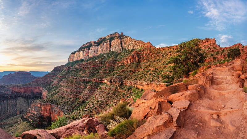
PARKS Atlas
A hiker with trekking poles and a backpack walks along a rocky rim trail at the Grand Canyon, with sweeping views of the layered red sandstone canyon walls u…

Arizona · National Park · Trails

Hiking in Grand Canyon

Bright Angel and South Kaibab descend a mile into the Earth — the question is how far down you're going and when you'll turn around.

Map

Explore Grand Canyon

Explore more

Trails

Hiking in Grand Canyon — rim to river

Grand Canyon hiking starts with one question: how far below the rim do you want to go? The South Rim sits at 6,860 feet; the Colorado River is 4,400 feet lower. Bright Angel Trail is the main descent route — water stations at 1.5 and 3 miles make it the safest choice for day hikers; South Kaibab is steeper, exposed, and offers the best ridge views but has no water below the rim. The NPS recommends 3 miles round-trip as the outer limit of a summer day hike, and turning around before 10am. These trails span the full range: a paved rim walk you can do in sandals to a 20-mile two-day haul to the river.

A well-worn hiking trail carved into the canyon wall leads the eye deep into the vast layered buttes and plateaus of the Grand Canyon, with green shrubs clin…

1.5 Mile Resthouse via Bright Angel Trail

3.5 mi 1,151 ft gain 2.2 hr

Hard Out & back

The first real descent into Bright Angel Trail — 1.5 miles down to the first resthouse with water and shade, then back up. Rated Hard not for distance but for the climb out; the heat inside the canyon makes what looks like an easy turn-around genuinely dangerous in summer.

A well-worn hiking trail carved into the canyon wall leads the eye deep into the vast layered buttes and plateaus of the Grand Canyon, with green shrubs clin…

3-Mile Resthouse via Bright Angel Trail

6.5 mi 2,106 ft gain

Hard Out & back

The 3-Mile Resthouse is the standard day-hike turnaround for serious hikers — halfway down Bright Angel with river views opening up and a 2,100 ft climb back out. NPS recommends stopping here for most day visitors in summer; below this point the heat and exposure become significantly more serious.

View from Bright Angel Trail at Grand Canyon National Park in winter, Arizona, USA.

Bright Angel Trail

16.4 mi 4,501 ft gain

The full rim-to-river Bright Angel Trail — 8.2 miles one-way down to the Colorado River, dropping 4,380 feet through every geological layer of the canyon. Bright Angel is the main-water trail with the most water sources (seasonal at 1.5 and 3-mile resthouses, year-round at Havasupai Gardens); the standard route for overnight canyon hikers. Not a day hike.

A well-worn hiking trail carved into the canyon wall leads the eye deep into the vast layered buttes and plateaus of the Grand Canyon, with green shrubs clin…

Bright Angel Trail to Havasupai Gardens

9.2 mi 3,034 ft gain

Hard Out & back

Bright Angel to Havasupai Gardens (formerly Indian Garden) — the 4.6-mile inner-canyon oasis with cottonwood trees, year-round water, and wildlife that surprises most rim-bound visitors. The climb back up is 3,000 feet; NPS strongly discourages this as a summer day hike due to heat accumulation in the inner canyon.

A panoramic view of the Grand Canyon's layered red and ochre sandstone formations stretching into a hazy blue distance, photographed from the South Rim near …

Havasupai Gardens Campground via Bright Angel

4.8 mi 0 ft gain

Hard Point to point Permit required

The one-way descent from the South Rim to Havasupai Gardens Campground — 4.8 miles with no elevation gain (all downhill from the rim) but zero ft gain is misleading since the return adds 3,034 ft back up. Listed as one-way for permit holders camping at the Gardens.

Aerial-perspective view of the Grand Canyon at twilight, showing layers of red and gray sandstone buttes receding toward the North Rim under a pink and magen…

Hopi Point via West Rim Trail

3.9 mi 390 ft gain 1.5 hr

Moderate Out & back Kid friendly

The West Rim Trail out to Hopi Point — one of the South Rim's most expansive viewpoints, accessible by shuttle from Hermits Rest Road (no private vehicles permitted). Nearly flat along the rim with 390 feet of modest rolling elevation; the views here are among the widest unobstructed panoramas on the South Rim.

A sweeping aerial view of the Grand Canyon from the South Rim, showing layered red and brown sandstone formations descending to the Colorado River visible in…

Maricopa Point, Powell Point and Hopi Point via West Rim Trail

4.4 mi 459 ft gain 1.7 hr

Moderate Out & back Dog friendly Kid friendly

A multi-viewpoint rim walk hitting Maricopa, Powell, and Hopi Points along the West Rim — three progressively more spectacular overlooks in 4.4 miles of paved and unpaved rim trail. One of the most efficient ways to cover the best western South Rim viewpoints in a single morning.

A panoramic view of the Grand Canyon's South Rim from a railed overlook, where layered red and orange sandstone buttes and mesas stretch toward the horizon u…

Mather Point via Visitor Center

0.5 mi 29 ft gain 10 min

Easy Out & back Dog friendly Kid friendly

A flat 0.5-mile walk from the Visitor Center to Mather Point, the South Rim's most visited overlook — the first canyon view most visitors see, and the one that sets the scale. Railed and paved, universally accessible, and appropriately overwhelming for anyone standing at the rim for the first time.

A well-worn hiking trail carved into the canyon wall leads the eye deep into the vast layered buttes and plateaus of the Grand Canyon, with green shrubs clin…

Plateau Point Trail via Bright Angel Trail

12.3 mi 3,257 ft gain

Hard Out & back

Bright Angel Trail to Plateau Point — 6.1 miles one-way to a flat promontory that juts into the inner canyon with a direct view of the Colorado River 1,300 feet below. One of the most dramatic inner-canyon day-hike destinations; the 3,257 ft round-trip climb and 12.3-mile total distance make this a serious full-day commitment for fit hikers only.

A winding, sediment-laden river flows through a deep canyon corridor flanked by towering red and tan sandstone cliffs, viewed from an elevated rocky vantage …

Rim Trail: Grand Canyon Village to Hermit's Rest

8.2 mi 501 ft gain 2.9 hr

Moderate Point to point Dog friendly

The full western Rim Trail from Grand Canyon Village to Hermit's Rest — 8.2 miles of rim walking with nine named viewpoints along the way, served by the free Hermit Road shuttle in the return direction. The definitive South Rim walk for visitors with a full day; no canyon descent required.

A panoramic view of the Grand Canyon's South Rim from a railed overlook, where layered red and orange sandstone buttes and mesas stretch toward the horizon u…

Rim Trail: Mather Point to Bright Angel Trailhead

6 mi 442 ft gain 2.2 hr

Easy Out & back Dog friendly Kid friendly

The eastern Rim Trail from Mather Point to the Bright Angel Trailhead — the most accessible and heavily-trafficked rim walk, paved for most of its length and connecting the park's main visitor hub to the top of the canyon's most famous descent trail. A natural route for anyone starting at the Visitor Center.

A rustic stone-and-log observation building perches at the edge of the Grand Canyon's South Rim, surrounded by pinyon pine and juniper trees.

Rim Trail: Yavapai Geology Museum to Verkamp's

1.5 mi 55 ft gain 33 min

Easy Point to point Dog friendly Kid friendly

A short 1.5-mile rim stroll from Yavapai Geology Museum to Verkamp's Visitor Center — the easiest introduction to the South Rim's eastern viewpoint corridor, with interpretive geology signage that makes the canyon's stratigraphy legible for non-geologists.

A well-worn hiking trail carved into the canyon wall leads the eye deep into the vast layered buttes and plateaus of the Grand Canyon, with green shrubs clin…

South Kaibab, Phantom Ranch, and Bright Angel Trail

17.3 mi 4,812 ft gain

Strenuous Point to point Permit required

The classic Grand Canyon through-hike: down South Kaibab to the river, overnight at Phantom Ranch, and back out via Bright Angel — 17.3 miles through the full stratigraphy of the canyon. This is the definitive Grand Canyon backpacking route, done by permit holders typically over 2–3 days.

A stone-stepped hiking trail winds down the South Rim of the Grand Canyon past red sandstone rocks and green shrubs, with a tall pale limestone butte and lay…

South Kaibab Trail to Cedar Ridge

3.4 mi 1,181 ft gain 2.2 hr

Hard Out & back

South Kaibab to Cedar Ridge — 1.7 miles one-way down the ridgeline with 360-degree canyon views that Bright Angel's sheltered corridor never offers. No shade, no water; rated Hard because the exposed ridge bakes in sun and the 1,181 ft climb out hits in full afternoon heat. The most visually rewarding short inner-canyon hike on the South Rim.

A switchback hiking trail carved into the layered red and tan sandstone walls of the Grand Canyon, viewed from above at mid-morning with soft diffused light …

South Kaibab Trail to Ooh Aah Point

2 mi 662 ft gain 1.3 hr

Moderate Out & back Kid friendly

South Kaibab's famous first payoff — just 1 mile down to a ridgeline viewpoint that earns its name. At 662 feet of descent, this is the accessible inner-canyon view for visitors who can handle a real trail but not a full-day push; no water or shade, so early morning starts are mandatory in warm weather.

A stone-stepped hiking trail winds down the South Rim of the Grand Canyon past red sandstone rocks and green shrubs, with a tall pale limestone butte and lay…

South Kaibab Trail to Phantom Ranch

14.8 mi 4,924 ft gain

Hard Out & back Permit required

South Kaibab all the way to Phantom Ranch and back — 14.8 miles and nearly 5,000 feet of gain on a trail with no water and no shade. Almost never done as a single day hike; listed as out-and-back for permit holders staying at Phantom Ranch before returning the same way or via Bright Angel.

A stone-stepped hiking trail winds down the South Rim of the Grand Canyon past red sandstone rocks and green shrubs, with a tall pale limestone butte and lay…

South Kaibab Trail to Skeleton Point

6.1 mi 2,027 ft gain

Hard Out & back

South Kaibab to Skeleton Point — the farthest day-hike turnaround NPS recommends on this trail, at the canyon's Tonto Platform with Colorado River views directly below. At 6.1 miles and 2,027 feet of gain on a shadeless ridge, this is a serious day hike even for fit hikers; the river is tantalizingly close but another 1,700 feet down.

A stone-stepped hiking trail winds down the South Rim of the Grand Canyon past red sandstone rocks and green shrubs, with a tall pale limestone butte and lay…

South Kaibab Trail to Tip Off

9.3 mi 3,261 ft gain

Hard Out & back

South Kaibab to Tip Off — the last flat rest area before the final descent to the river, at 9.3 miles round-trip and 3,261 feet. An emergency phone and toilet here mark it as the last practical turn-around point before the descent becomes genuinely committing; almost no one day-hikes beyond this point.

A well-worn hiking trail carved into the canyon wall leads the eye deep into the vast layered buttes and plateaus of the Grand Canyon, with green shrubs clin…

South Kaibab Trail, Tonto Trail, and Bright Angel Trail

13.7 mi 3,458 ft gain

Strenuous Point to point Permit required

The Tonto Trail connector between South Kaibab and Bright Angel — a 13.7-mile point-to-point that links the two main South Rim corridors at the Tonto Platform, traversing inner-canyon terrain that most visitors never see. A multi-day backpacking route for experienced hikers with a backcountry permit.

Tourists gather at a fenced overlook on the South Rim of the Grand Canyon, seated on rustic log benches beneath gnarled juniper trees while the layered red a…

Yavapai Point via Rim Trail

1.7 mi 85 ft gain 34 min

Easy Out & back Dog friendly Kid friendly

An easy 1.7-mile out-and-back from Mather Point to Yavapai Geology Museum — the South Rim's best interpretive geology stop, with a glassed observation room built into the rim and exhibits that make the 1.7-billion-year canyon cross-section readable for non-scientists.

North Kaibab Trail

29.5 mi 6,870 ft gain

Strenuous Out & back

The North Kaibab is the North Rim's corridor trail and the least-visited, most demanding of the Grand Canyon's inner-canyon routes, descending steep switchbacks through narrow side canyons to the Colorado River with water stations at Cottonwood and Manzanita. Most hikers tackle the full 29.5-mile out-and-back as a multi-day backpacking trip; Supai Tunnel and Roaring Springs are common day-hike turnarounds from the rim. The NPS strongly warns against hiking from the rim to the river and back in a single day because of extreme inner-canyon heat and a 6,000-plus-foot climb out, and search-and-rescue calls are routine. Any overnight camping requires a backcountry permit, and the North Rim is seasonal, generally open mid-May through mid-October.

A panoramic view across the Grand Canyon at sunset, with layered red and orange sandstone buttes and mesas lit by warm golden light receding into a hazy blue…

Rim to Rim

24.2 mi 5,278 ft gain

Strenuous Point to point

This point-to-point crossing descends the North Kaibab from the North Rim through Roaring Springs Canyon and along Bright Angel Creek to the canyon floor, then climbs the Bright Angel Trail to the South Rim, with water at Cottonwood Camp, Phantom Ranch, Bright Angel Campground, and Havasupai Gardens. Most hikers take three to five days, four being typical at roughly six miles a day; the best windows are mid-May to mid-June and mid-September to mid-October, and summer is strongly discouraged for extreme heat. Because the North Rim Lodge and campground generally close mid-October through mid-May, plan around that season and arrange a return via the seasonal Trans-Canyon Shuttle, since this is a one-way route. Overnight backcountry permits are required for all camping and are notoriously hard to get, so reserve well in advance through the NPS, and never attempt the rim-to-river-and-back in one day.

Trail data powered by AllTrails. Save offline maps, see live conditions, and download GPX tracks with AllTrails+.

Grand Canyon trail conditions alerts

One email when smoke, storm, or fire affects Grand Canyon trail access. Trail-specific — not the same as our lodging alerts.

Save on Entry

One pass covers Grand Canyon — and every other US national park.

The America the Beautiful annual pass pays for itself in two or three park visits. Free entry, free passenger fees, and no more fumbling for a credit card at the kiosk.

America the Beautiful National Park Pass — the 2026 annual pass card Buy your pass → Learn more about the pass

Ships from US Park Pass. Free shipping in the continental US.