PARKS Atlas
A powerful waterfall cascades down a sheer granite cliff face in Yosemite National Park, likely Vernal Fall, surrounded by lush conifer forests and rocky ter…

California · National Park · Trails

Hiking in Yosemite

Valley floor waterfalls and high-country granite — Yosemite's two hiking landscapes, sorted by what you're after and when you can get there.

Map

Explore Yosemite

Explore more

Trails

Hiking in Yosemite

Yosemite's trails split between two landscapes, and the split matters for your planning. Valley floor trails — the Mist Trail to Vernal and Nevada Falls, the Lower Yosemite Falls loop, Mirror Lake — run year-round and pack into a single shuttle day. High-country trails (Clouds Rest, Sentinel Dome, Tuolumne Meadows) require Glacier Point Road or Tioga Road to be open, which typically means June through October depending on snowpack. Half Dome is the park's signature permit hike: 17 miles and 5,300 feet of gain to the cables, with a day-use permit via lottery required for the summit section from late May through mid-October. Secure the permit first, then plan the rest of the day around it.

Snow-covered granite cliffs and waterfalls of Yosemite Valley rise sharply against a deep blue winter sky, with frost-laden evergreens lining the valley floo…

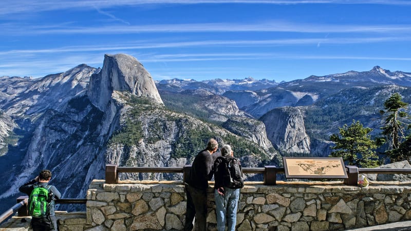
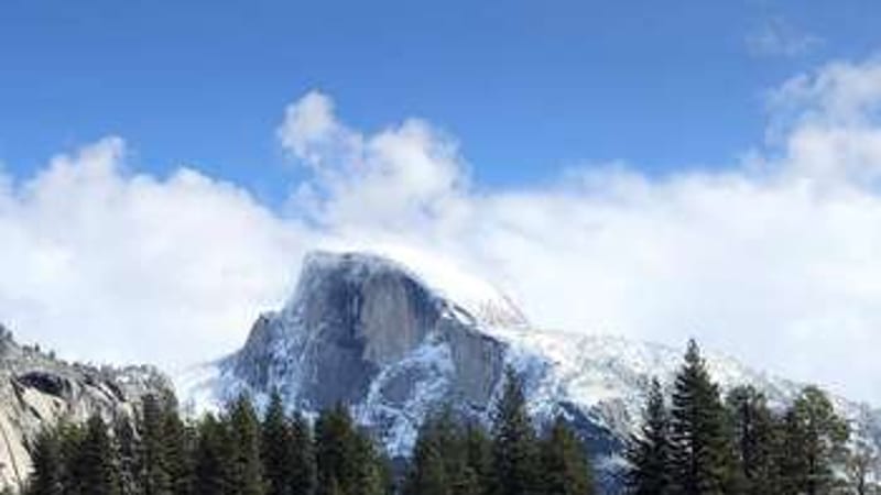
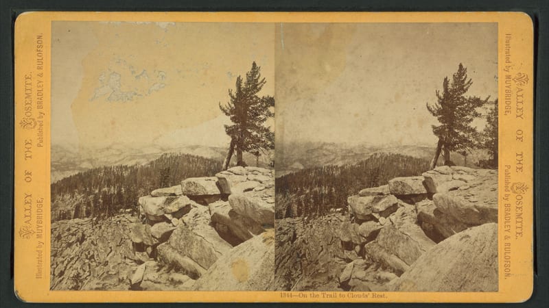
Clouds Rest Trail from Yosemite Valley

18.2 mi 6,204 ft gain 11.8 hr

Strenuous Out & back

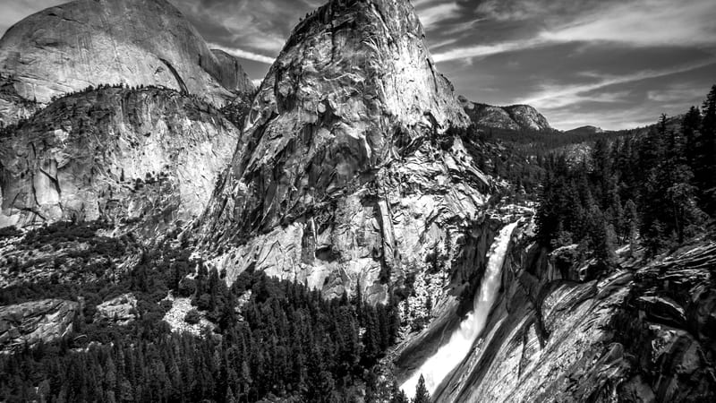
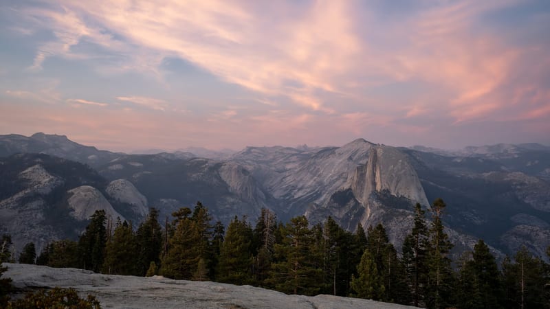
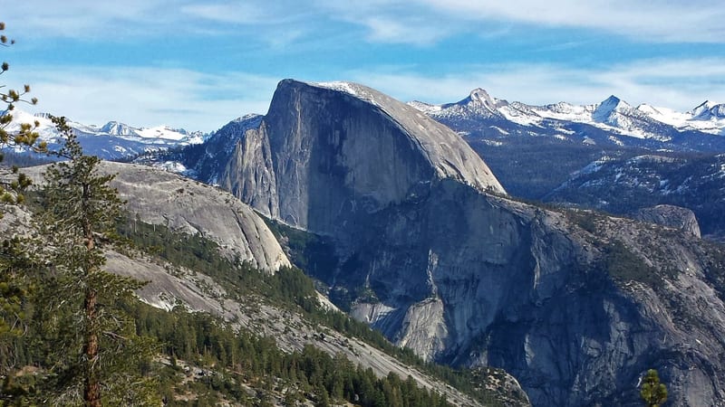
An 18.2-mile round-trip from the Valley floor to the Clouds Rest summit, with panoramic views of Half Dome and the Sierra Nevada that many argue surpass the more crowded Half Dome summit — without requiring a permit.

Visitors at Glacier Point overlook gaze across Yosemite Valley toward the sheer granite face of Half Dome, with the Sierra Nevada range extending to the hori…

Glacier Point Trail

0.6 mi 49 ft gain 13 min

Easy Loop Kid friendly

A paved 0.6-mile loop at the Glacier Point overlook — accessible to most visitors and delivering one of the park's most dramatic views: Half Dome, Yosemite Falls, and the full Valley floor from 3,200 feet above.

A tall, two-tiered waterfall cascades down sheer granite cliffs in Yosemite Valley, viewed across the calm Merced River framed by a mix of dark conifers and …

Half Dome via Little Yosemite Valley

7.1 mi 2,667 ft gain 4.8 hr

Strenuous Out & back

A 7.1-mile out-and-back to Little Yosemite Valley — the backpackers' basecamp on the Half Dome approach — delivering Merced Canyon views and sub-dome terrain without committing to the full summit route.

A tall, narrow waterfall drops down a sheer granite cliff face in Yosemite Valley, framed by dark green conifers and a rocky streambed in the foreground.

Little Yosemite Valley

7.9 mi 2,342 ft gain 4.7 hr

Hard Out & back

A 7.9-mile route from the Valley through the Mist Trail corridor and into the sandy meadow of Little Yosemite Valley — passing Vernal and Nevada Falls and ending in the quiet backpackers' camp beside the Merced River.

Cathedral Peak, a distinctive granite spire in Yosemite's high country, rises above Upper Cathedral Lake, whose calm surface creates a near-perfect mirror re…

Little Yosemite Valley via John Muir Trail

10.6 mi 2,641 ft gain 5.8 hr

Hard Out & back

A 10.6-mile JMT approach to Little Yosemite Valley that trades the Mist Trail's staircase spray for a switchback-heavy but slightly drier climb through forest and granite — a longer route to the same backcountry camp with a different character.

A snow-covered Yosemite Valley in winter, with frost-dusted conifers in the foreground and a tall waterfall cascading between towering granite cliffs partial…

Lower Yosemite Falls Trail

1.2 mi 59 ft gain 24 min

Easy Loop Dog friendly Kid friendly

A flat 1.2-mile paved loop to the base of Lower Yosemite Fall — the most accessible waterfall experience in the park, with a mist-sprayed viewing area just steps from the shuttle stop, suitable for strollers and dogs.

A shaded forest road winds through tall conifers in Yosemite Valley, with a brown National Park Service directional sign pointing toward Happy Isles (0.6 mil…

Mirror Lake Loop

5.1 mi 305 ft gain 1.8 hr

Easy Loop

A 5.1-mile loop around Mirror Lake and Tenaya Creek at the base of Half Dome — best in spring when the lake reflects Half Dome's north face in still water; by late summer the lake is a meadow.

A shallow, clear river curves past a sandy bank lined with pine trees, with towering granite cliff faces rising behind the forest in Yosemite National Park.

Mirror Lake Paved Trail

2.1 mi 121 ft gain 43 min

Easy Out & back Kid friendly

A 2.1-mile paved out-and-back to Mirror Lake — the easiest route to the Half Dome reflection viewpoint, suitable for younger kids and accessible visitors who want more than the Lower Yosemite Falls loop.

A shallow, clear river curves past a sandy bank lined with pine trees, with towering granite cliff faces rising behind the forest in Yosemite National Park.

Mirror Lake via Valley Loop Trail

4.4 mi 305 ft gain 1.6 hr

Moderate Loop Kid friendly

A 4.4-mile Valley Loop route that passes Mirror Lake and the meadow beyond — a slightly longer version of the Mirror Lake experience that adds variety by looping Tenaya Creek through a mixed forest before returning to the Valley shuttle.

The classic Tunnel View panorama of Yosemite Valley shows El Capitan rising on the left, Half Dome in the distance, and Bridalveil Fall cascading on the righ…

Nevada Fall via the Mist Trail

5.9 mi 2,125 ft gain 3.9 hr

Hard Out & back

A 5.9-mile Mist Trail climb past Vernal Fall's spray wall to Nevada Fall's 594-foot drop — the signature Yosemite hike for visitors who want a substantial waterfall experience and can handle granite staircase climbing at altitude.

A calm river meanders through Tuolumne Meadows in Yosemite's high country, reflecting granite domes and conifer forests under a clear blue sky.

Nevada Falls

7.6 mi 2,309 ft gain 4.6 hr

Hard Out & back

A 7.6-mile out-and-back to Nevada Fall that takes the John Muir Trail route up and can be looped back via the Mist Trail — offering a slightly longer, switchback-based approach to the same waterfall destination as the direct Mist Trail option.

Half Dome's sheer granite face rises above Yosemite Valley, viewed from an elevated granite overlook lined with conifers.

Sentinel Dome and Taft Point Loop

5.2 mi 1,108 ft gain 2.7 hr

Moderate Loop

A 5.2-mile Glacier Point Road loop hitting both Sentinel Dome (360° Sierra panorama) and Taft Point (sheer Valley-edge overlook with slot fissures) — two very different viewpoint characters in a single moderate day hike that requires no permit.

A sweeping high-country granite landscape in Yosemite National Park at twilight, featuring Tenaya Lake nestled among polished granite domes with snow-capped …

Upper Yosemite Falls Trail

6.7 mi 3,238 ft gain 5.3 hr

Hard Out & back

A 6.7-mile, 3,238-foot climb to the top of North America's tallest waterfall — Yosemite Falls' upper tier — with Valley-floor views that open progressively as you gain the switchbacks above the Lower Falls viewpoint.

Half Dome's distinctive sheer granite face rises above a forested ridge in Yosemite National Park, with snow-dusted Sierra Nevada peaks stretching across the…

Valley Loop Trail to Snow Creek Foot Bridge

7.6 mi 2,716 ft gain 5.0 hr

Hard Out & back

A 7.6-mile route from the Valley floor up Snow Creek to a footbridge with Tenaya Canyon views — a quieter, less-trafficked alternative to the Mist Trail corridor that delivers significant elevation and excellent canyon perspective.

El Capitan, the massive granite monolith of Yosemite Valley, rises vertically through low mist and clouds against a deep blue sky, with its pale face reflect…

Vernal and Nevada Falls via Mist Trail

6.7 mi 2,191 ft gain 4.2 hr

Hard Loop

The Mist Trail's signature loop — 6.7 miles past Vernal Fall's mist-soaked granite staircase and up to Nevada Fall, with a return via the John Muir Trail — the single best introduction hike in Yosemite for fit visitors.

A large waterfall drops from a granite cliff into a white-water rocky river, flanked by green forest trees and a gray granite dome visible in the background.

Vernal Fall Foot Bridge via John Muir Trail

1.8 mi 492 ft gain 1.0 hr

Moderate Out & back Kid friendly

A 1.8-mile moderate hike up the JMT to the Vernal Fall footbridge — the easiest point from which to see a major Yosemite waterfall in full roar, without the steep granite staircases of the full Mist Trail.

A panoramic view from Glacier Point in Yosemite National Park shows Half Dome rising prominently in the center, with a vivid rainbow arcing to its left under…

Vernal Falls

3.3 mi 1,141 ft gain 2.1 hr

Hard Out & back

A 3.3-mile out-and-back to the top of Vernal Fall via the Mist Trail's famous spray-soaked granite staircase — the shortest route to a major Yosemite summit and one of the most visceral hikes in the park when the fall is running full.

A massive giant sequoia tree fills the frame from a low ground-level perspective, its deeply furrowed reddish-brown bark and fire-scarred base towering above…

Mariposa Grove of Giant Sequoias

6.8 mi 1,220 ft gain 3.5 hr

Moderate Out & back Kid friendly

Yosemite's giant-sequoia walk, in the Wawona corner of the park. The lower-grove 2.2-mile loop reaches the headline trees — the Grizzly Giant and the walk-through California Tunnel Tree — while the full 6.8-mile route climbs past the Galen Clark Tree to the Wawona Point vista. A free shuttle runs from the Mariposa Grove parking area, which fills by mid-morning. Over 300 sequoias grow here, some close to 2,000 years old.

El Capitan's massive granite face dominates the frame from Yosemite Valley floor, viewed across an open meadow with scattered pines and deciduous trees in th…

El Capitan Summit Hike

14.5 mi 4,819 ft gain 9.5 hr

Hard Out & back

The hiker's route to the top of El Capitan — the granite wall climbers ascend via The Nose. It's a strenuous 14.5-mile day with nearly 5,000 feet of climbing, up the Yosemite Falls trail's switchbacks past Columbia Rock before the traverse to the summit. Most visitors take in El Capitan from the valley floor instead; this is for very fit hikers who want to stand on top. Start before dawn, carry plenty of water, and expect snow on the route into late spring.

Wapama Falls Trail

4.9 mi 1,085 ft gain 2.6 hr

Moderate Out & back Kid friendly

The signature Hetch Hetchy hike - across the top of O'Shaughnessy Dam and along the reservoir's north shore to Wapama Falls, which thunders over a series of footbridges in spring, passing Tueeulala Falls on the way. Best April-June at peak flow; the bridges can be impassable at the highest water.

Rancheria Falls Trail

12.9 mi 2,634 ft gain

Hard Out & back

A long out-and-back along the reservoir to Rancheria Falls - the full Hetch Hetchy shoreline, far quieter than the Yosemite Valley trails and often done as a backpacking overnight. Bears are active here; a permit and bear canister are required to camp.

Lookout Point Trail

2.8 mi 547 ft gain 1.4 hr

Moderate Out & back

A short climb from near the Hetch Hetchy entrance to a granite outcrop with the first open view over the reservoir and Kolana Rock - a quick leg-stretch if you're not committing to the dam hike.

Trail data powered by AllTrails. Save offline maps, see live conditions, and download GPX tracks with AllTrails+.

Yosemite trail conditions alerts

One email when smoke, storm, or fire affects Yosemite trail access. Trail-specific — not the same as our lodging alerts.

Save on Entry

One pass covers Yosemite — and every other US national park.

The America the Beautiful annual pass pays for itself in two or three park visits. Free entry, free passenger fees, and no more fumbling for a credit card at the kiosk.

America the Beautiful National Park Pass — the 2026 annual pass card Buy your pass → Learn more about the pass

Ships from US Park Pass. Free shipping in the continental US.