PARKS Atlas
A hiker with trekking poles and a backpack stands on a rocky ridge gazing at the snow-capped summit of Mount Rainier, bathed in warm golden morning light aga…

Washington · National Park · Trails

Hiking in Mount Rainier

Paradise wildflowers, Sunrise glacier views, Carbon River rainforest — three zones, three entirely different days.

Map

Explore Mount Rainier

Explore more

Trails

Trails across Mount Rainier's three zones

Rainier's trails break into three zones, and picking the right one changes the whole day. Paradise (south side, ~5,400 ft) is the wildflower headline — the Skyline Trail loops through meadows mid-July through mid-August, and the Camp Muir route climbs to 10,188 ft for anyone wanting the summit experience without roped glacier travel. Sunrise (northeast, ~6,400 ft) is higher, less crowded, and open later in the season — better views of the Emmons Glacier and the Cascade Range. Carbon River (northwest, ~1,800 ft) is the opposite of alpine: temperate rainforest, old-growth, and a wet, green quiet that feels nothing like the snowfields above — but its only road has been closed since April 2025 (the SR-165 Fairfax Bridge is out, no alternate route), so for 2026 it is reachable only by a long backcountry hike; plan around Paradise and Sunrise. Altitude is real on the high routes — give yourself 20 minutes at the trailhead before pushing hard.

A wide snowfield at high elevation on Mount Rainier is dotted with colorful camping tents, surrounded by dark volcanic rock ridges and cliffs under a clear b…

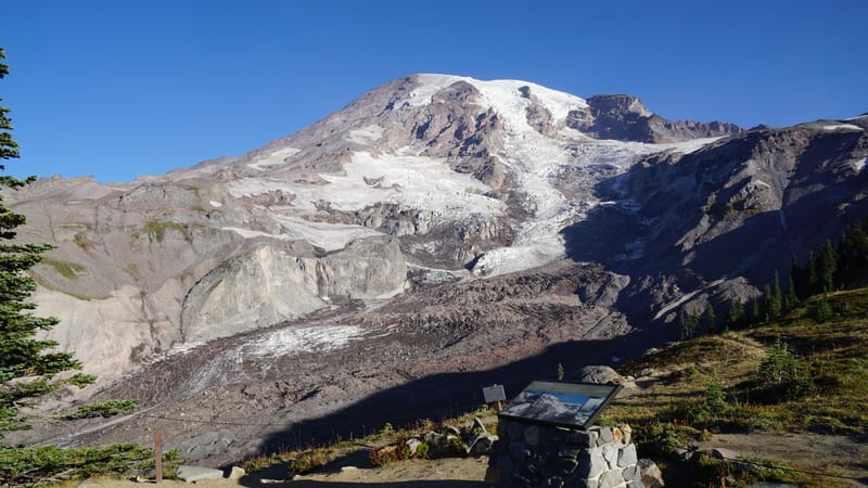
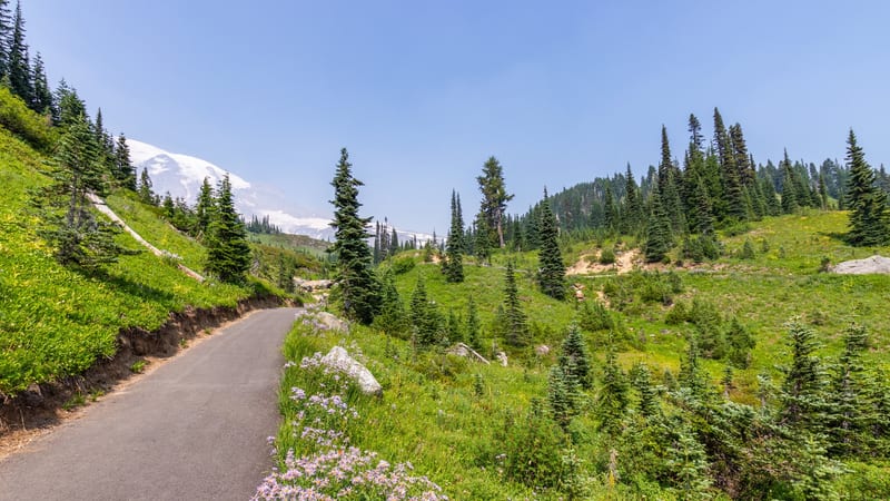
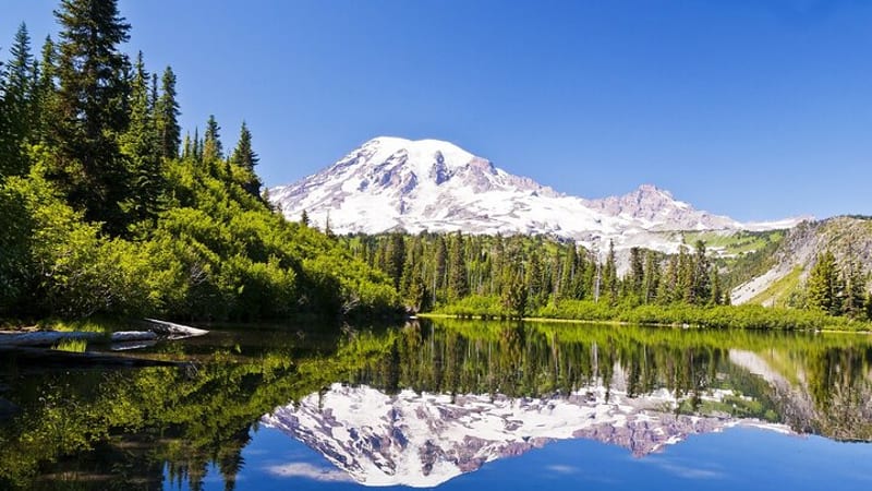
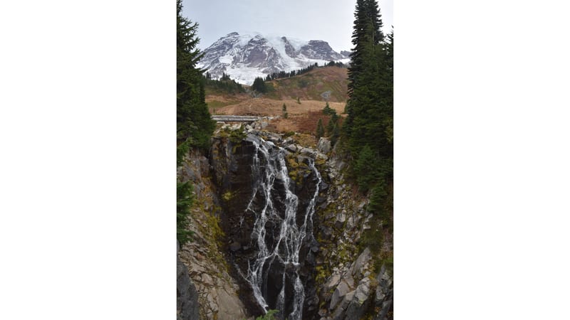
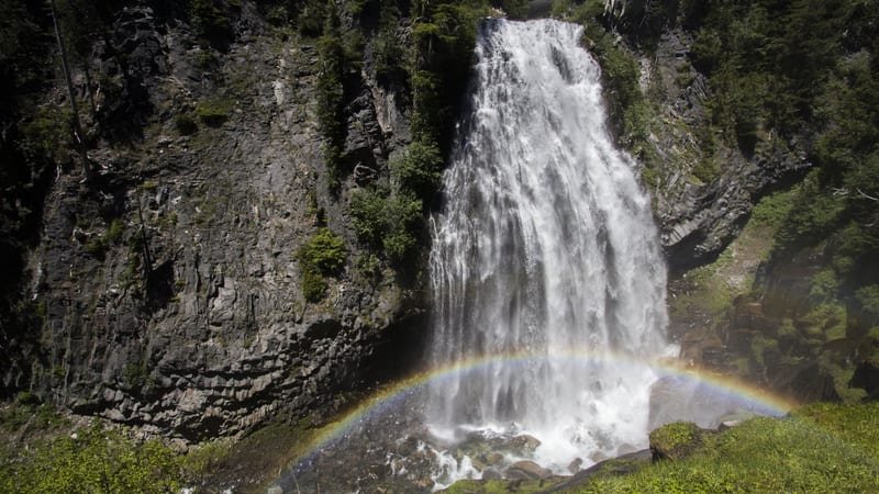
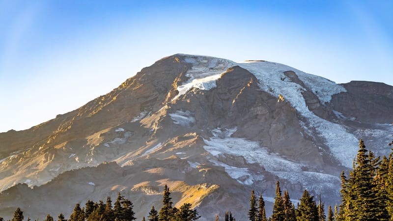
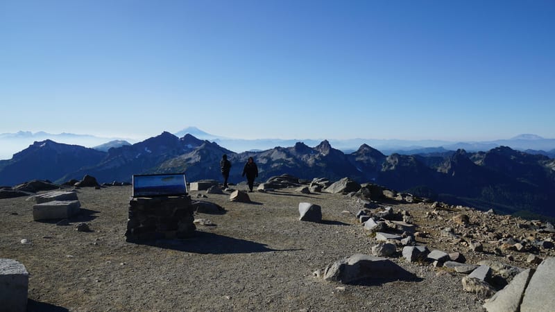
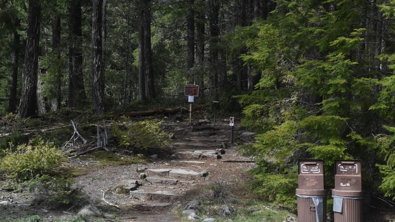
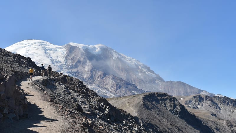
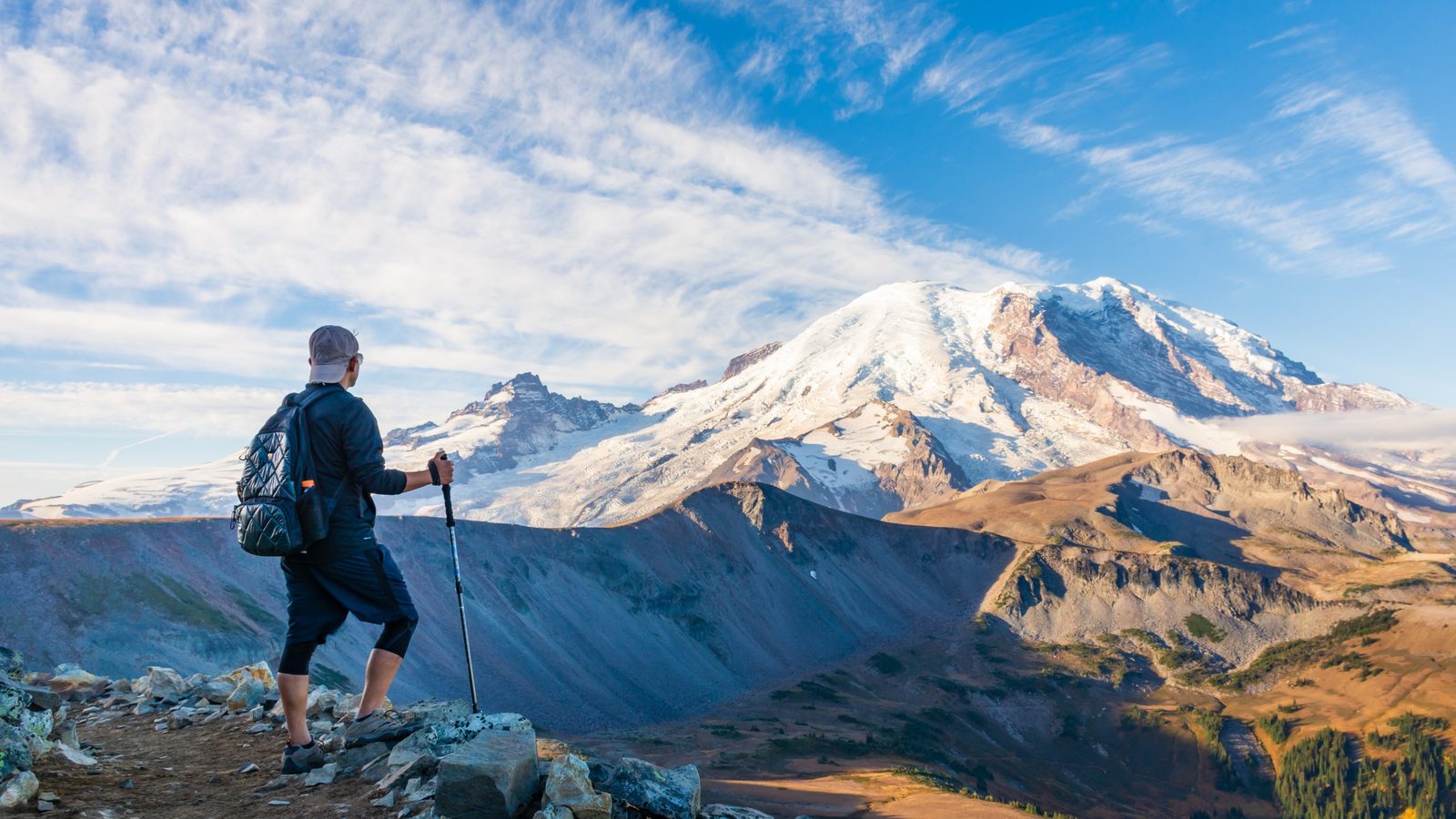
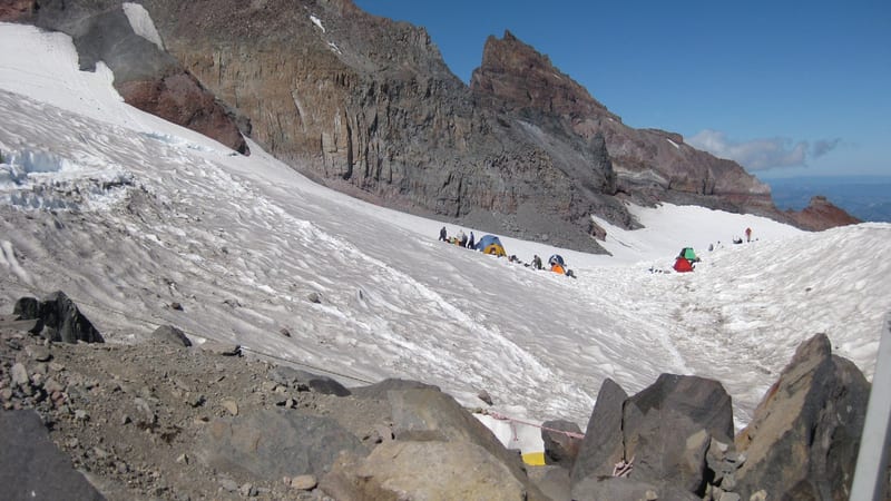
Camp Muir Route via Skyline Trail

9.1 mi 4,648 ft gain 7.5 hr

Strenuous Out & back

The summit approach trail to Camp Muir (10,188 ft) — Rainier's high camp and the staging point for technical summit climbs above. This is as far as the standard visitor goes without a climbing registration; the route crosses the Muir Snowfield and delivers the fullest above-treeline experience in the park without roped glacier travel.

A multi-tiered waterfall cascades down dark moss-covered rocks through a dense Pacific Northwest old-growth forest, framed by towering conifers and fallen lo…

Carter and Madcap Falls via Wonderland Trail

2.5 mi 515 ft gain 1.3 hr

Moderate Out & back Kid friendly

A short, forested out-and-back along the Wonderland Trail from the Cougar Rock area to two closely spaced waterfalls — Carter Falls and Madcap Falls — on the Paradise River. A reliable family hike even mid-summer when the upper trails are crowded.

A tall multi-tiered waterfall cascades down a sheer volcanic rock cliff face framed by evergreen trees, with bright midday sunlight illuminating the white wa…

Comet Falls via Van Trump Trail

3.6 mi 1,286 ft gain 2.4 hr

Hard Out & back

A strenuous 3.6-mile out-and-back to Comet Falls, one of the tallest waterfalls in Washington state at 320 feet — the steep approach through old-growth forest earns it. Trailhead is on the Nisqually Road between the entrance and Longmire, making it accessible without fighting Paradise parking.

A paved trail curves through a green subalpine meadow dotted with purple wildflowers and conifer trees, with the glacier-covered peak of Mount Rainier visibl…

Mount Fremont Lookout Trail via Sourdough Ridge Trail

5.8 mi 1,118 ft gain 2.8 hr

Moderate Out & back

The top-rated moderate hike from the Sunrise area (the northeast, highest-road-accessible part of the park at 6,400 ft) — 5.8 miles out and back to a 1930s fire lookout with unobstructed 360-degree views of Rainier, Mount Baker, and Mount Adams. Sunrise is typically 10–15°F cooler than Paradise in summer.

Mount Rainier's snow-capped volcanic summit towers above a glacially carved river valley, viewed from an elevated wildflower meadow at sunset with vivid pink…

Mount Rainier Standard Summit Route

15.4 mi 9,035 ft gain

Strenuous Out & back Permit required

The technical summit route to Rainier's 14,411-ft crater rim — not a hiking permit but a climbing registration (Climbing Cost Recovery Fee, paid to the NPS via Recreation.gov or on-site at Paradise or White River). Requires roped glacier travel, crevasse navigation skills, and proper mountaineering equipment; most climbers hire a guide through Rainier Mountaineering Inc. (RMI) for their first ascent. Camp Muir (10,188 ft) is the overnight staging point on the standard south-side route.

A multi-strand waterfall cascades down a dark basalt rock face at Mount Rainier National Park, with the snow-capped summit and glaciers of Mount Rainier visi…

Myrtle Falls Viewpoint via Skyline Trail

1 mi 160 ft gain 27 min

Moderate Out & back Kid friendly

A 1-mile paved-to-dirt walk from the Paradise Visitor Center to the Myrtle Falls overlook — the most accessible waterfall view in the park, with Rainier framed behind the falls on clear days. One of the only trails in Paradise that works for strollers and visitors with limited mobility.

A powerful waterfall cascades down dark basalt cliffs surrounded by dense conifer forest, with a vivid rainbow arcing across the base where mist rises from t…

Narada Falls

0.2 mi 59 ft gain 8 min

Easy Out & back Kid friendly

A 0.2-mile roadside walk to the base of Narada Falls, a 168-foot cascade on the Paradise River just below the Paradise Road — the shortest significant waterfall hike in the park, accessible as a quick stop on the drive from the Nisqually entrance to Paradise.

Upper volcanic slopes of Mount Rainier with glaciers on the right flank and warm sunlight on the rocky western face, viewed from Paradise with subalpine firs…

Nisqually Vista Trail

1.1 mi 180 ft gain 30 min

Easy Loop Kid friendly

A 1.1-mile paved loop from the Paradise area to a viewpoint over the Nisqually Glacier and its outwash plain — a short, easy option for understanding how glaciers shape the landscape without leaving the Paradise zone. Good for families who have already done Myrtle Falls and want a second quick loop.

A high-alpine rocky summit plateau at Mount Rainier National Park, with two hikers near an interpretive sign and a sweeping panorama of the Tatoosh Range and…

Panorama Point via Skyline Trail

3.8 mi 1,325 ft gain 2.5 hr

Hard Out & back

A 3.8-mile out-and-back from Paradise to Panorama Point at 6,800 ft — the single best view of the south face of Rainier and the Nisqually Glacier from a non-summit vantage. Harder than it looks because the final push to the point is steep and often on packed snow into July.

A granite retaining wall engraved with an 1889 John Muir quote frames a snow-dusted alpine meadow and conifer forest below the snow-capped peak of Mount Rain…

Paradise Glacier Trail

3.6 mi 1,082 ft gain 2.2 hr

Moderate Out & back

A 3.6-mile moderate trail from Paradise into the upper Paradise Glacier area, historically leading to ice caves in the glacier — note that the caves have largely collapsed as the glacier retreats; the trail itself remains one of the least-crowded Paradise routes with excellent wildflower coverage in mid-July.

Hikers walk a paved path through a rocky subalpine meadow with scattered evergreen trees and a jagged mountain ridgeline in the background under a clear blue…

Skyline and Alta Vista Trail

1.6 mi 567 ft gain 1.1 hr

Moderate Loop Kid friendly

A compact 1.6-mile loop combining the start of the Skyline Trail with the Alta Vista knoll — the best short loop at Paradise that actually gains elevation above treeline and delivers a full 360-degree wildflower view. Often the right call when younger kids need a manageable distance but the group wants real alpine scenery.

Hikers walk a paved path through a rocky subalpine meadow with scattered evergreen trees and a jagged mountain ridgeline in the background under a clear blue…

Skyline and Golden Gate Loop

3.9 mi 1,112 ft gain 2.3 hr

Moderate Loop

A 3.9-mile loop taking in the lower Skyline Trail and the Golden Gate section above — the standard intermediate loop at Paradise that most guides recommend as the baseline Rainier hiking experience. Hits wildflower meadows, waterfall views, and an above-treeline vantage without the full Skyline Loop commitment.

A worm's-eye view looking straight up through a grove of towering coast redwood or giant sequoia trees, their massive fibrous trunks converging toward a brig…

Skyline, Glacier Vista, Upper Skyline and Golden Gate Loop

4.7 mi 1,614 ft gain 3.0 hr

Hard Loop

The extended Skyline variant that adds the Glacier Vista detour and Upper Skyline traverse before coming back via Golden Gate — 4.7 miles and 1,614 ft of gain, rated 4.9. This is the 'full Paradise day' loop that takes you to a close glacier view, wildflower meadows, and summit-adjacent ridgeline all in one circuit.

Hikers walk a paved path through a rocky subalpine meadow with scattered evergreen trees and a jagged mountain ridgeline in the background under a clear blue…

Skyline Loop

5.7 mi 1,781 ft gain

Hard Loop

The full Skyline Loop — 5.7 miles with 1,781 ft of gain — is Rainier's signature Paradise hike. It circles the entire Paradise basin, reaching Panorama Point on the upper traverse and descending through wildflower meadows that peak mid-July to mid-August. If you're making one trip to Rainier, this is the hike.

A forested trail entrance at what appears to be Mount Rainier National Park, featuring stone steps leading up into a dense conifer forest with a brown Nation…

Wonderland Trail

86.7 mi 24,399 ft gain 50.6 hr

Hard Loop Permit required

The Wonderland Trail encircles Mount Rainier on an 86.7-mile loop through forests, subalpine meadows, river valleys, and exposed alpine terrain. This is a multi-day backpacking objective, not a day hike: a wilderness permit is required for every overnight stay and camping is limited to designated backcountry camps. Two-thirds of summer permits (June through September) go to advance registration and the rest are first-come, first-served, so plan ahead. The best window is July through September, after the high country melts out and the trailhead roads are open.

A rocky alpine trail winds along a ridgeline with Mount Rainier's glaciated upper slopes dominating the background under a clear blue sky.

Burroughs Mountain Trail

8.9 mi 2,463 ft gain 5.1 hr

Hard Out & back

Starting from Sunrise, this 8.9-mile out-and-back climbs to the most accessible alpine tundra in the Cascade Range, with close-up views of Mount Rainier and the surrounding peaks. The route follows an exposed ridgeline with little shade, so bring sun protection and plenty of water, and stay on the trail to protect the fragile tundra. Because it leaves from Sunrise, the trail is reachable only when the Sunrise Road is open, roughly July through September; the best months are June through September. Wildflowers and frequent wildlife sightings, including mountain goats, are common along the way.

A vivid turquoise alpine lake sits nestled in a forested valley surrounded by dense subalpine fir trees, with layers of hazy blue-green mountain ridges reced…

Naches Peak Loop Trail

3.5 mi 669 ft gain 1.7 hr

Moderate Loop Kid friendly

This family-friendly 3.5-mile loop circles Naches Peak on the east side of Mount Rainier, starting from the Tipsoo Lake area about half a mile west of Chinook Pass on SR 410. Part of the route follows the Pacific Crest Trail and a portion lies outside the park boundary. It is best as a late-summer wildflower loop: the meadows peak then, and snow can linger into early season, so spikes or poles help on a snowy day. The trailhead is reachable only when Chinook Pass (SR 410) is open, roughly July through October, since the road closes in winter.

A sheer basalt cliff face rises steeply above a rocky talus slope, with scattered subalpine fir trees clinging to ledges and a small fire lookout tower perch…

Tolmie Peak Lookout

5.8 mi 1,538 ft gain 3.8 hr

Moderate Out & back

Currently inaccessible: the Tolmie Peak trailhead near Mowich Lake is reached only via the SR-165 Fairfax Bridge, which closed permanently in April 2025 — no vehicle, bike, or foot access, and the NPS says reopening is unknown. When access returns, this 5.8-mile out-and-back climbs past alpine lakes and subalpine meadows to the Tolmie Peak Fire Lookout, a two-story structure with views of Mount Rainier; the route follows the Wonderland Trail through Ipsut Pass up to Eunice Lake, where many hikers stop before the steep final climb to the lookout.

Trail data powered by AllTrails. Save offline maps, see live conditions, and download GPX tracks with AllTrails+.

Mount Rainier trail conditions alerts

One email when smoke, storm, or fire affects Mount Rainier trail access. Trail-specific — not the same as our lodging alerts.

Save on Entry

One pass covers Mount Rainier — and every other US national park.

The America the Beautiful annual pass pays for itself in two or three park visits. Free entry, free passenger fees, and no more fumbling for a credit card at the kiosk.

America the Beautiful National Park Pass — the 2026 annual pass card Buy your pass → Learn more about the pass

Ships from US Park Pass. Free shipping in the continental US.